

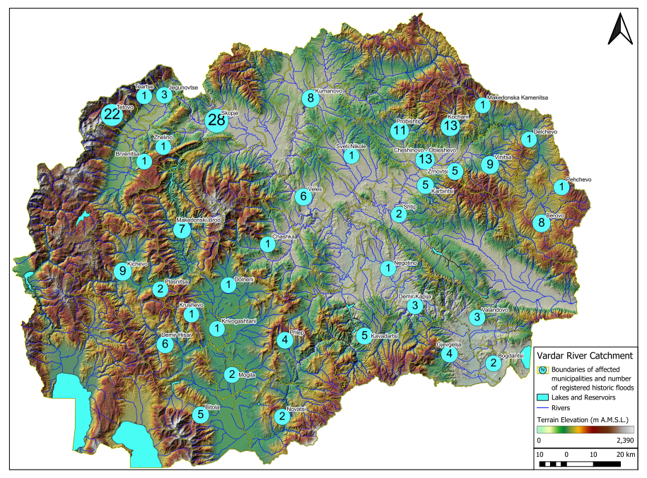
The hydrographic territory of North Macedonia belongs to the following river basins: the Vardar River basin, which gravitates towards the Aegean Sea, the Crn Drim River basin, which includes the Prespa and Ohrid Lake basins, gravitates towards the Adriatic Sea, and the Strumica River basin gravitates towards the Aegean Sea. A very small part of the hydrographic territory flows into the catchment area of the Juzna Morava River. These main river basins are divided into ten sub-basins: Lepenec, Pcinja, Bregalnica, Strumica, Treska, Crna Reka, Crn Drim, Upper Vardar, Middle Vardar and Lower Vardar basins.
The Vardar River Basin, which includes the sub-basins Lepenec, Pchinja, Bregalnica, Treska, Crna Reka, Upper Vardar, Middle Vardar and Lower Vardar Basins, covers 80 percent of the total water bodies in the country, making it a key resource in as many as 68 municipalities.
The project “Improved Implementation of the EU Floods Directive through Harmonization of National Legislation and Preparation of Flood Risk Management Plans” has collected historical data from official sources for the implementation of its activities, which provide an overview of floods over the years.
The oldest record of a flood dates back to 1778, archived in the records of the old Skopje Metropolitanate. Also archived are data on floods in 1858, 1876, the floods in 1895 and 1897, in which the center of Skopje suffered the most, which was the reason for the first regulation of the riverbed by Hafus Pasha – the governor of Skopje, in 1903 and 1916, in which the regulation helped prevent the Vardar from overflowing onto the left bank, but Skopje Field was completely flooded.
Regular hydrological monitoring of the water level of the rivers in the country began in the period 1923/1924. Also, in the period before 1923, there are no observations of precipitation according to which an assessment of high waters could be made.
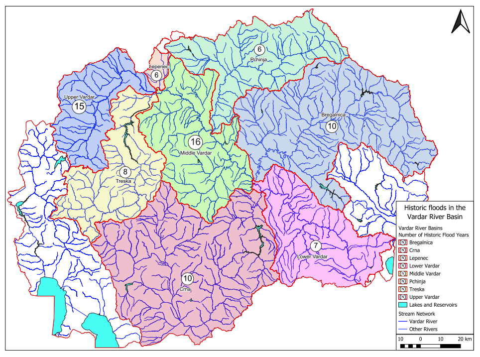
The collected historical data for the period from 1778 to 2022 register 199 floods in the Vardar basin. Most of the floods occurred on the Bregalnica River, with 70 recorded, and the Vardar River with 68.
Tabular overview of historical floods in the Vardar Basin (by river sub-basin):
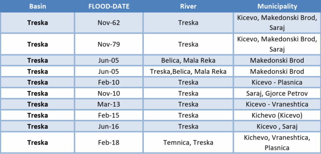
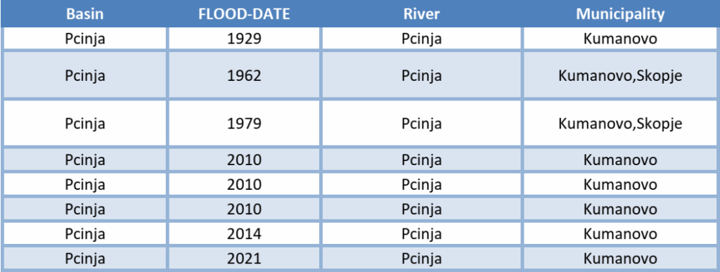
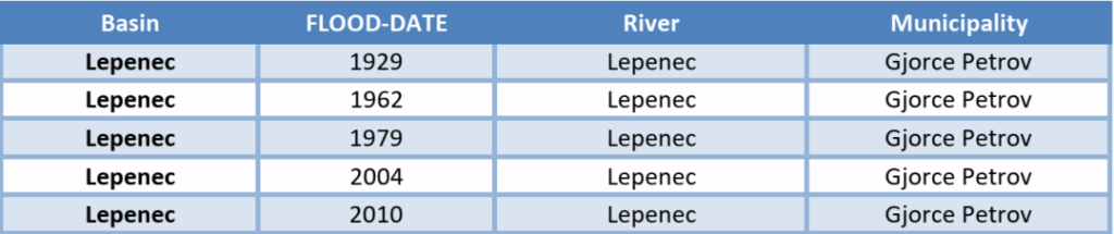
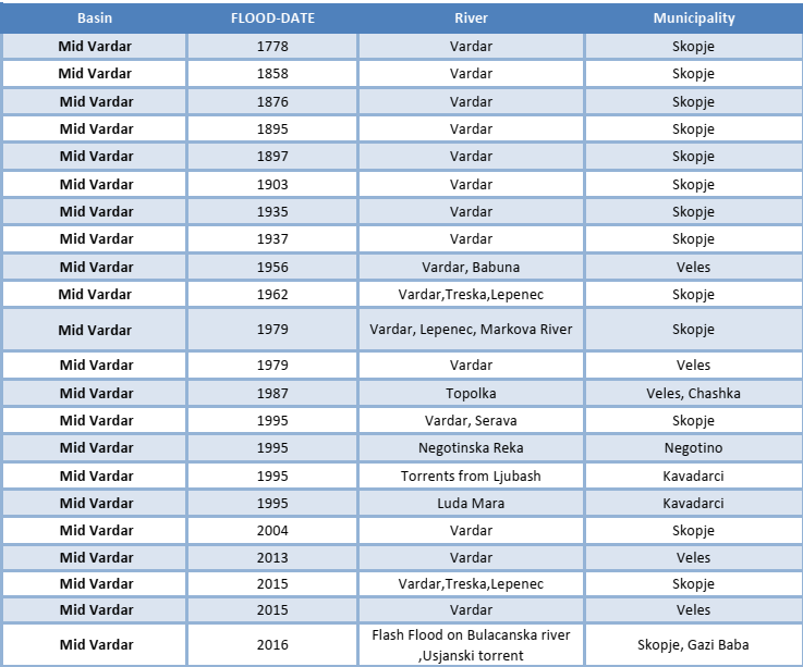
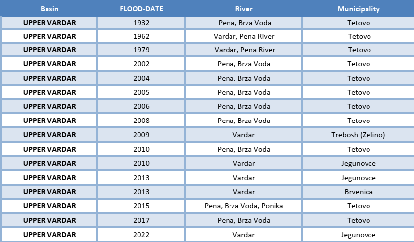
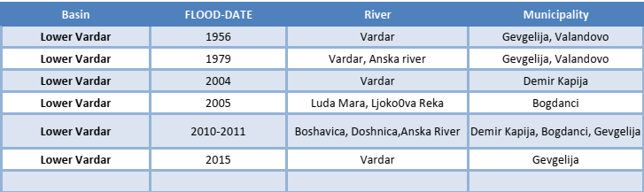
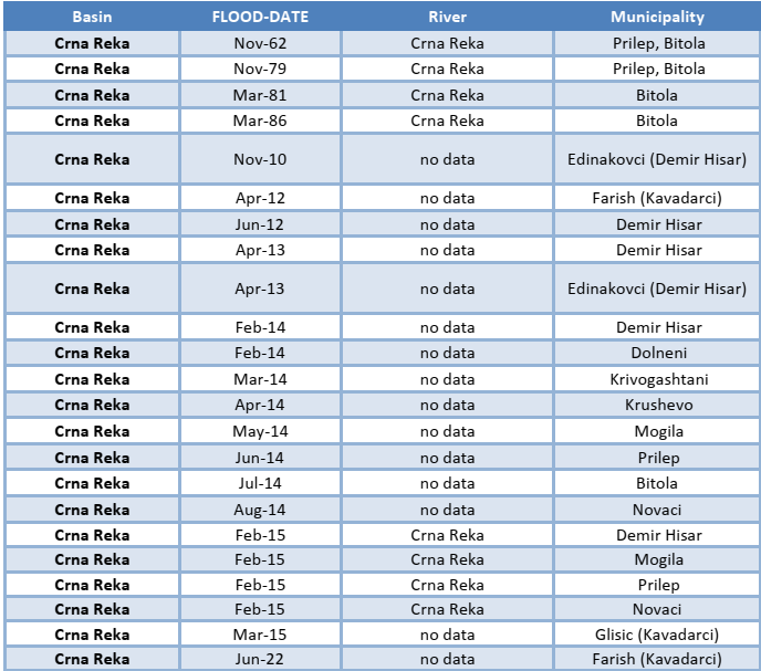
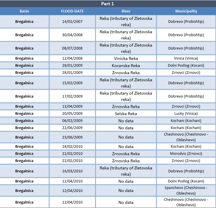
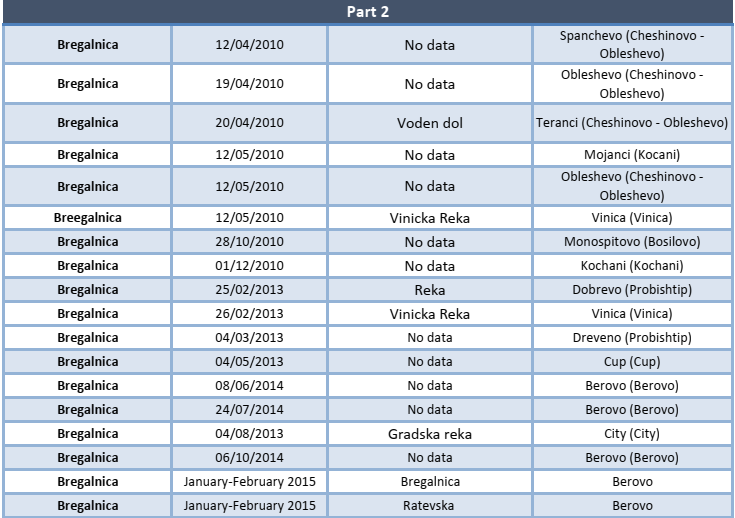
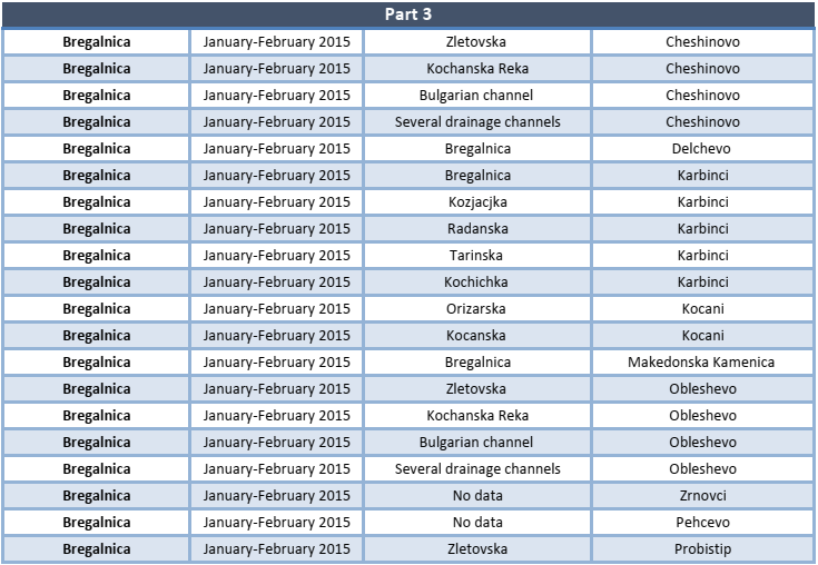
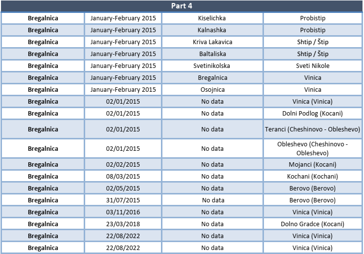
These data show that North Macedonia is particularly vulnerable to floods, and is already facing both extreme storms and more frequent droughts. The period between 2014 and 2016 stands out with heavy rains that caused major floods, leading to significant losses and even to the tragic loss of 22 lives in August 2016.
Flood risks are increasing due to both natural and human causes. Recent disasters have shown major weaknesses in the way floods are monitored, managed and responded to. There is now a wider understanding that stronger action is needed – not only better engineering, but also better planning, preparation and investment in prevention, which is the aim of the project “Improved Implementation of the EU Floods Directive through Harmonization of National Legislation and Preparation of Flood Risk Management Plans”.
By aligning with the EU Floods Directive, North Macedonia will improve its management of catastrophic flood risks and better protect people, land and livelihoods from future climate impacts.